ConnectField, the mobile GIS solution dedicated to audits, surveys, inventories, and construction site monitoring..
Optimize your field operations with the ConnectField mobile app
Get accurate, trustworthy mapping data
Make your field operations faster and more efficient
Streamline communication between the field and the office
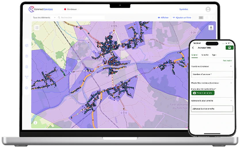
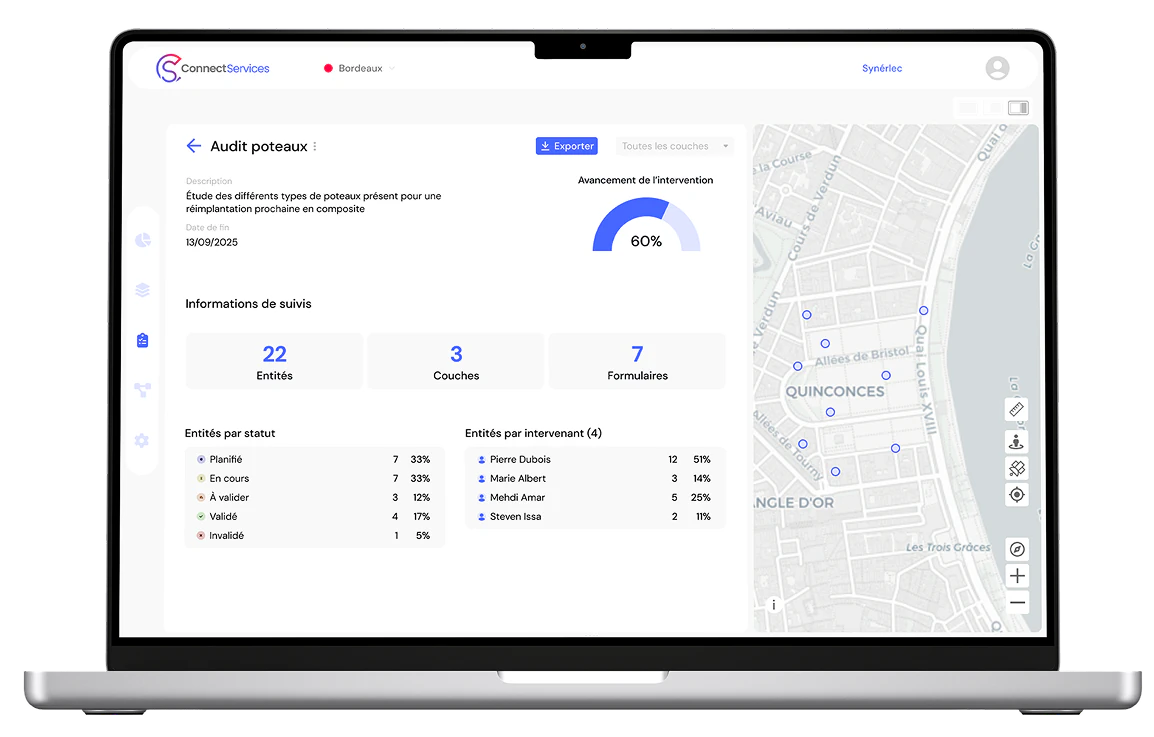
Optimize your operations with our all-in-one solution: ConnectField syncs effortlessly with ConnectServices WebGIS to manage interventions, visualize your data, and drive geospatial insights
Optimize your field surveys, audits, and working site monitoring from just €15/month!
Try it free for 15 daysDigitize your data, improve your information collection
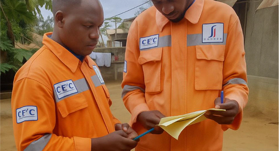
Examples of field operations carried out with ConnectField
Use Case #1: Preliminary surveys for network equipment renewal
A public works company needs to install smart water meters on a LoRa network. Before the intervention, its teams must:
- Map existing infrastructure and identify the locations of old meters.
- Conduct field audits to verify installation compatibility
- Plan operations with ConnectServices and assign tasks to technicians.
- Monitor work progress in real time and generate an installation report.
With ConnectField, the company reduces data entry errors and speeds up equipment commissioning
Use case #2 : Inspection and pruning planning for an overhead fiber optic network
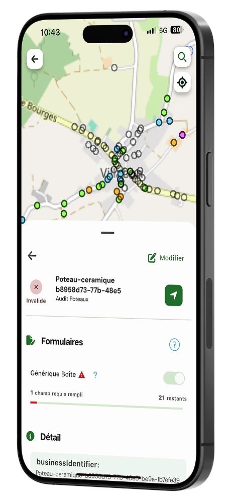
Equipped with the ConnectField app, your field teams can visually inspect overhead infrastructure and identify, geolocate, and qualify pruning-related risks on your network.
- Load all geographic data of the overhead line to be monitored onto the technician’s smartphone
- Follow the line and geolocate the risk area
- Qualify the situation using the form and photo report
- Centralize and visualize collected data in the ConnectServices WebGIS
- Plan the appropriate maintenance operations
With ConnectField, pruning teams have access to all the information they need to adapt their operations and respond as quickly as possible!
Available on smartphone and tablet


Start boosting your productivity today — just like our clients already do!
Start my free 15-day trial now!Frequently Asked Questions (FAQ)
What is a mobile GIS solution?
A Geographic Information System (GIS) is a digital platform used to capture, store, manipulate, analyze, manage, and present spatial and geographic data. When the system is mobile — as is the case with ConnectField — its features are directly accessible from the field, without needing to be in the office or connected to a desktop computer.
What are the use cases for a mobile GIS solution?
A mobile GIS solution or field intervention app like ConnectField supports many use cases such as network maintenance (water, electricity, telecom…) by allowing users to visualize infrastructure, record outages, and log interventions. It also plays a key role in land management by mapping plots, buildings, or natural areas. Mobile GIS is especially valuable for crisis management and civil safety, helping localize incidents and track emergency teams.
Can it be used offline?
Yes, the ConnectField mobile GIS solution works even without internet or mobile coverage. Data is saved locally in the app and synchronized by the user once a connection is restored.
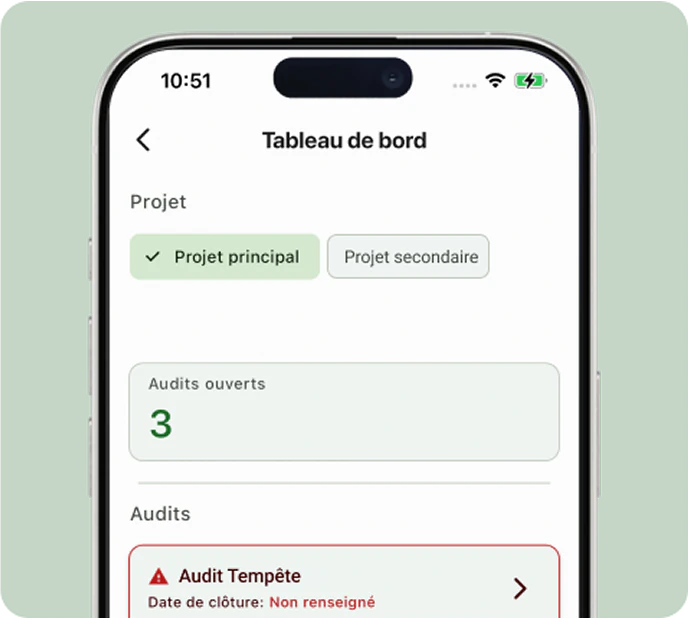
Does ConnectField support construction site monitoring and audits?
Yes, the ConnectField field app streamlines the management of audits and site follow-ups by enabling step validation, punch list resolution, intervention control, and compliance report generation.
What are the technical requirements?
None — as long as your smartphone’s operating system is up to date! Our solution is available as a SaaS platform on mobile and web browsers, with no complex installation required. Performance depends on your device’s capabilities.
Does ConnectField offer built-in navigation?
Yes, the app can send site or survey location coordinates to your preferred navigation apps such as Apple Maps, Google Maps, or Waze, making it easier to plan technician routes.
Are the forms customizable?
Yes! We already offer a library of forms, but they can be customized to your specific needs. Our team handles the configuration, and your custom forms are typically ready within 24–48 hours.
Is ConnectField compatible with other GIS platforms?
No, at this time, ConnectField is designed to work exclusively with the ConnectServices WebGIS, ensuring seamless and optimized integration. However, data exported from ConnectServices can be re-integrated into any GIS platform.
Can ConnectField calculate areas?
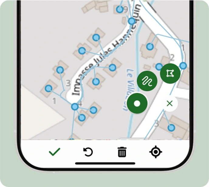
Yes, the “entity creation” feature allows users to define areas whose surface can be calculated directly on the ConnectServices platform. This is especially useful in real estate construction, agriculture, and forestry.
Can ConnectField calculate distances?
Yes, the same “entity creation” feature allows users to create lines, and their lengths can be calculated via ConnectServices..
Can ConnectField data be shared across multiple users?
Yes. ConnectField is designed to support geographic data sharing. Data access permissions are managed by the organization’s administrator through the intervention management interface in ConnectServices.
Experience ConnectField using your real data!
Stop wasting time with ineffective tools! Discover how the ConnectField mobile app, combined with the ConnectServices WebGIS, can transform the way you manage field operations, surveys, audits, and construction or maintenance follow-ups.
Get started now with the solution!